Hurricane Ian – Update 9 – 9/28/2022

University of Florida officials continue monitoring Hurricane Ian. Here is what we know today:
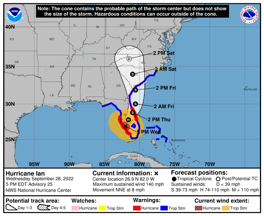
Hurricane Ian made landfall in Southwest Florida as a dangerous Category 4 storm, according to the Wednesday, 5 p.m. advisory from the National Hurricane Center. It is expected to move over Central Florida during the next day and emerge into the western Atlantic later Thursday.
Computer models continue to show the storm moving at a slower pace. As a result, tropical storm winds are expected to continue Wednesday night across Northeast and North Central Florida, which includes Alachua County. The weather will continue to deteriorate through Thursday, according to forecasters at the National Weather Service office in Jacksonville.
Hurricane-force winds are expected to continue to spread inland into Central Florida and along the east-Central Florida coast overnight through early Thursday. Heavy rainfall will spread across the Florida peninsula through Thursday and reach portions of the Southeast U.S. later this week and this weekend.
UF units should continue to monitor forecasts and follow guidance from local officials.
The University of Florida campus in Gainesville will be closed Wednesday, Sept. 28 through Friday, Sept. 30. Only essential university personnel should report for work during that time.
The university expects to reopen and resume classes and normal campus operations on Saturday, Oct. 1.
We will continue to monitor and update the UF community as Hurricane Ian makes its way over the Florida peninsula. Regularly check https://www.ufl.edu/ for updates.
For additional information, please visit National Hurricane Center.
Additional information:
UF classes canceled Wednesday – Friday
Commonly asked questions regarding UF campus closure
Here’s how to prepare for hurricane season
Pre-storm preparation for students in UF housing
UF/IFAS Disaster Preparation & Recovery
This story was posted at 8 p.m. on Wednesday, Sept. 28.


