Potential Tropical Cyclone Nine – Update #1 – 9/27/25
University of Florida officials are monitoring Potential Tropical Cyclone Nine due to the uncertainty surrounding its track, potentially placing UF units within the five-day forecast cone. While much remains unknown about the storm’s potential impact, here is what we know today:
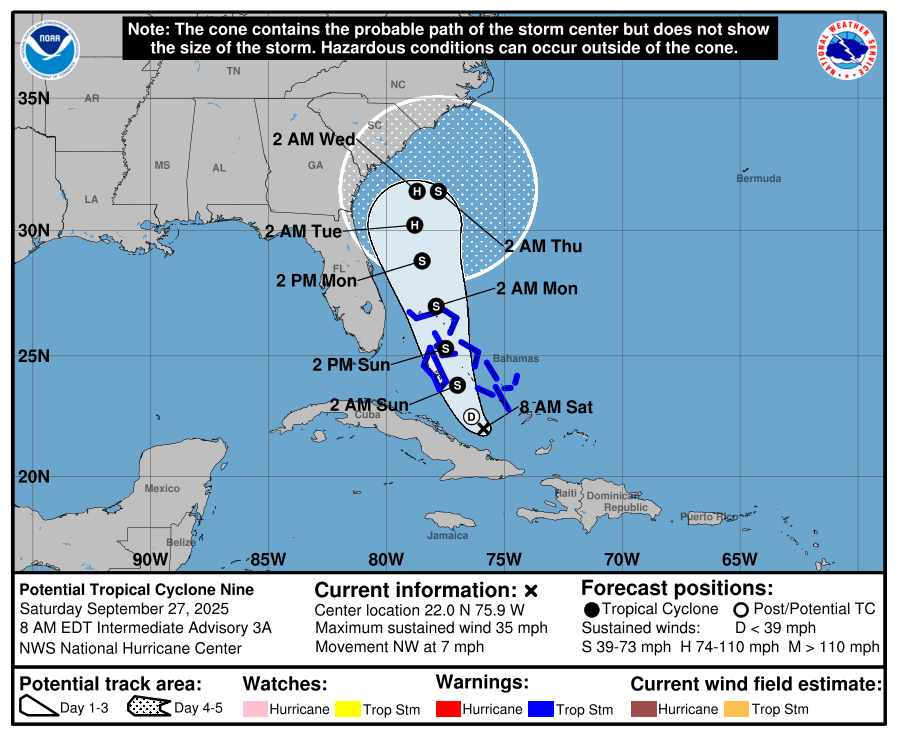
Potential Tropical Cyclone Nine is expected to gradually strengthen throughout the next 24 hours into a tropical storm, according to the National Hurricane Center. As the system slowly makes its way over the Bahamas and northward, it is projected to continue strengthening, becoming a hurricane by Monday night.
Forecasters are projecting the storm’s center will remain off the Florida coast as it heads north. National Weather Service forecasters estimate the probability of tropical-storm-force winds affecting South Florida is below 20% and Gainesville below 6%.
As such, no tropical storm warnings or watches had been issued for any portion of Florida as of Saturday morning, and no operational changes have been announced for the UF campus in Gainesville.
Still, forecasters at the National Hurricane Center have expressed concerns over the storm’s rainfall potential, given the uncertainty of its track. While the projected rainfall for the Gainesville campus is less than 1 inch, portions of the Florida coastline could see as much as 5 inches leading to localized flooding.
UF units along the East Coast of Florida should closely monitor forecasts and follow guidance from local officials.
We will continue to monitor and update all on expected impacts as information become available.
Additional information:
National Hurricane Center
Here’s how to prepare for hurricane season
Pre-storm preparation for students in UF housing
How to build an emergency kit
UF/IFAS Disaster Preparation & Recovery