


Tropical Storm Idalia – 8/28/23 – Update #5
University of Florida officials are actively monitoring Tropical Storm Idalia. While much remains unknown about the storm’s exact path, here is what we know thus far:
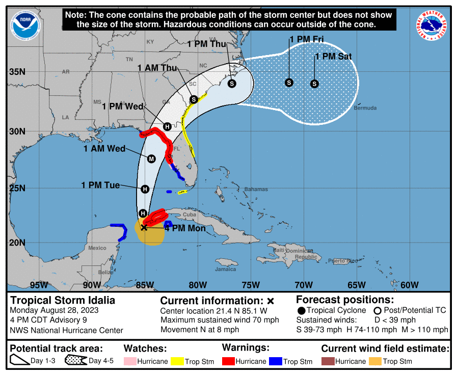
A Hurricane Warning has been issued from the middle of Longboat Key northward to Indian Pass. This includes Alachua County, west of Interstate 75. Eastern Alachua County, which includes the city of Gainesville, remains under a Hurricane Watch.
Additionally, a Hurricane Warning remains in effect for Sumter County, and the inland portions of Hernando, Hillsborough, Levy, Manatee, and Pasco counties. A Tropical Storm Warning is in effect from Chokoloskee to the middle of Longboat Key.
While Idalia remains a tropical storm, forecasters at the National Hurricane Center still expect the system to strengthen into a hurricane sometime Monday evening. Additionally, they expect the storm to rapidly intensify on Tuesday, as it travels over an “area of high ocean heat” in the Gulf of Mexico.
The National Hurricane Center expects the system will become a major hurricane before it reaches Florida’s Gulf Coast on Wednesday. Forecasters consider storms that are Category 3 and above major hurricanes.
Forecasters continue to stress that “only a small deviation in the track could cause a significant change in Idalia’s landfall location in Florida.” As a result, they are urging residents along Florida’s Gulf Coast to prepare for “destructive winds” once it makes landfall. “Strong winds will also spread inland across portions of northern Florida near the track of the center of Idalia,” the 5 p.m. National Hurricane Center advisory stated.
The National Weather Service Center in Jacksonville said the Gainesville area should prepare for hurricane-force winds ranging between 74 and 110 mph. The system is expected to make landfall along the coast as a Category 3 early Wednesday morning.
Conditions in Northeast Florida are expected to begin deteriorating on Tuesday afternoon and evening. Heavy rainfall will continue throughout Wednesday. Also, tornadoes will be possible Tuesday night and Wednesday.
UF announced on Monday, shortly after 4 p.m., that its Gainesville campus will close and classes will be canceled beginning at noon on Tuesday, Aug. 29, and continuing through Wednesday, Aug. 30. This includes all academic and student-related activities, including online classes and exams.
Essential employees should check with their supervisors regarding scheduling. UF Health and UF/IFAS personnel, and others at locations throughout the state should follow their local government’s guidance and check with their supervisors for information regarding reopening of their work locations.
Regularly check https://www.ufl.edu/ for updates.
For additional information, please visit National Hurricane Center.
Additional information:
UF campus closure, class cancellation
UF campus services and events updates
Here’s how to prepare for hurricane season
Pre-storm preparation for students in UF housing
UF/IFAS Disaster Preparation & Recovery
This story was posted at 6 p.m. on Monday, Aug. 28.