


Tropical Storm Idalia – 8/27/23 – Update #2
University of Florida officials are actively monitoring Tropical Storm Idalia. While much remains unknown about the storm’s exact path, here is what we know today:
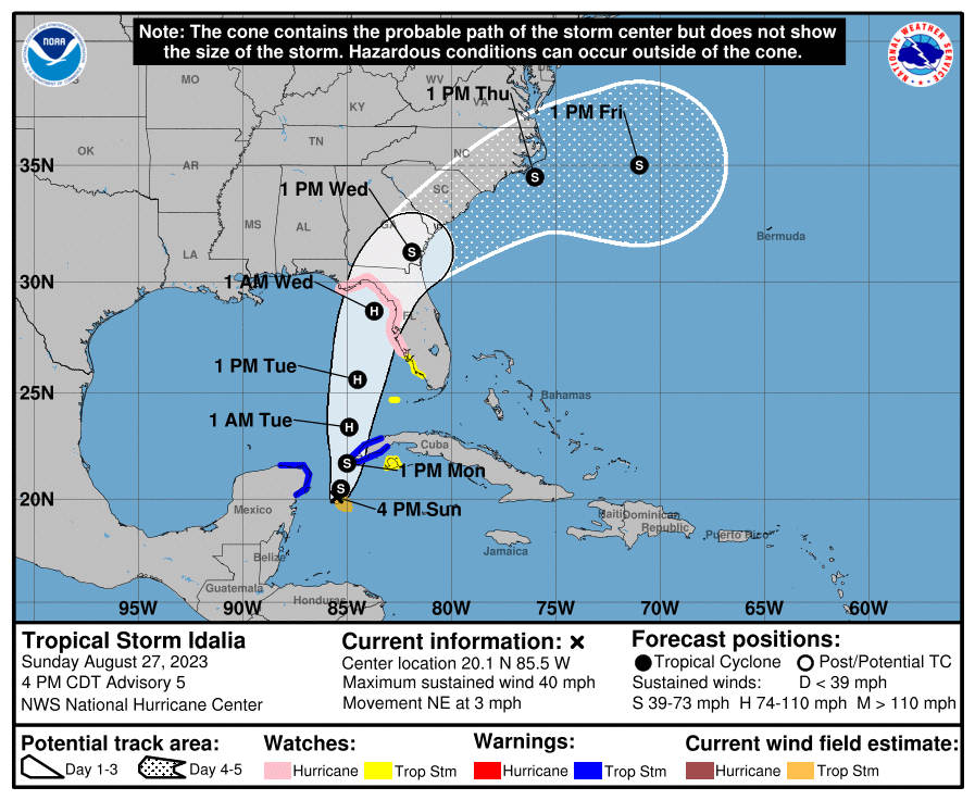
The National Hurricane Center issued a Hurricane Watch for the Gulf coast of Florida, from Englewood to Indian Pass, including Tampa Bay, in the 5 p.m. advisory. Also, a Tropical Storm Watch was issued for the Gulf coast of Florida, south of Englewood to Chokoloskee.
Tropical Storm Idalia is expected to strengthen into a hurricane as it travels over the eastern Gulf of Mexico. While forecasters noted earlier there was a “risk of rapid intensification,” the storm’s potential intensity remains unclear.
“There is considerable spread in the model intensity guidance, ranging from minimal to major hurricane status before landfall on the northeast Gulf coast,” according to the 5 p.m. advisory.
Forecasters said it’s still is too early to specify what parts of Florida the storm will impact. However, portions of the west coast of Florida and the Florida panhandle should expect strong winds, heavy rainfall, and dangerous storm surge by Tuesday evening.
UF interests statewide should closely monitor forecasts and be prepared to follow guidance from local officials. We will continue to monitor and update all on expected impacts or schedule changes as information becomes available.
For additional information, please visit National Hurricane Center.
Additional information:
Here’s how to prepare for hurricane season
Pre-storm preparation for students in UF housing
UF/IFAS Disaster Preparation & Recovery